Urban Age 10 | LSE Cities
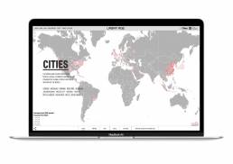
The Urban Age Programme, is an international investigation of the spatial and social dynamics of cities. TEKJA were approached by LSE Cities at London School of Economics to bring their vast collection of paper-based data visualisations and maps to ‘digital life’. The interactive works consist of interactive and animated maps, charts and graphs, allowing users to explore and compare how people move and live in major cities around the world.
The work involved consultancy on the data, spatial analysis and development of bespoke visualisation types such as multilayer maps, data matrix, multiline graphs, stacked bar charts, donut charts and others. All visualisations are highly interactive and were designed to bring another exploratory dimension to this rich collection of data.
Urban Age is online here.
ClientLondon School of EconomimcsOutputMaps, graphs and chartsYear2015-16
